Helene's fatal floods show hurricane risk is moving inland

This was the latest weather event to challenge assumptions about how to prepare for storms and other natural disasters.

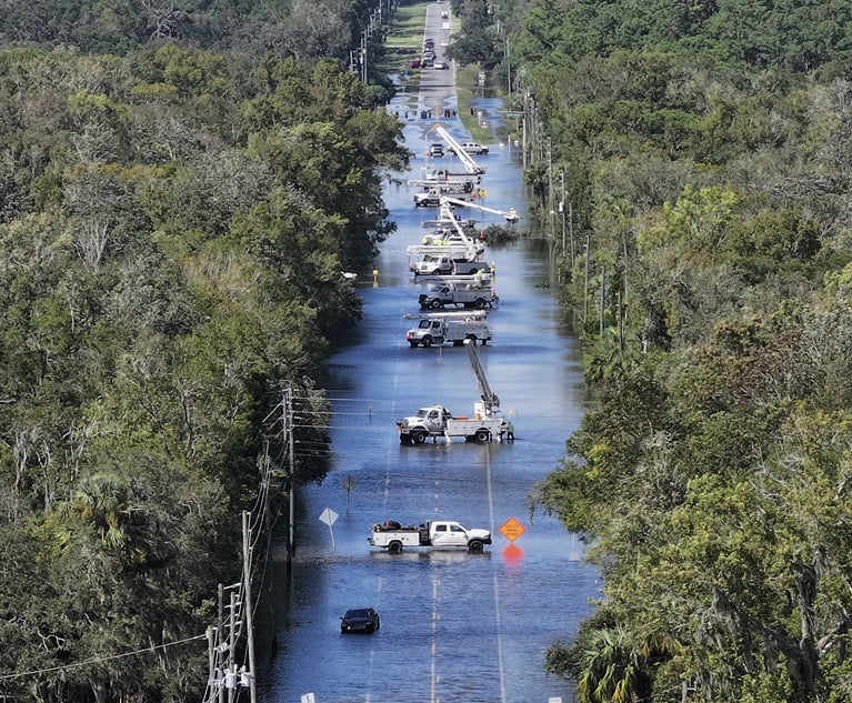
Power crews work on the lines after Hurricane Helene passes in Crystal River, Florida, on Sept. 27. (Photo credit: Joe Raedle/Getty Images via Bloomberg)

(Bloomberg) — Hurricane Helene killed more than 100 people in six states across the South, and most of the victims lived hundreds of miles away from where the storm made landfall.

Related: U.S. states at risk most of experiencing a severe hurricane

After striking Florida’s western coast last week, Helene unleashed catastrophic flooding across Appalachia. Its devastation came down to two primary factors: its massive size and the significant amount of moisture it absorbed over open water.

Sweltering ocean temperatures driven by climate change are allowing storms to pull in more water vapor, triggering torrential rainfall. And while researchers don’t attribute cyclone size to global warming, Helene’s width — with winds that extended more than 310 miles (499 kilometers) at landfall, it was larger than 90% of hurricanes in the region over the past two decades — meant that it inundated cities and towns far from the coast.

“Helene was, to put it directly, sort of the worst of all things,” said John Cangialosi, senior hurricane specialist with the US National Hurricane Center in Miami. “It’s one of those all-hazards hurricanes. You’ll hear that some storms are wind machines, and some are storm surge producers, and some bring rain. Helene produced all of these hazards — significantly.”

Helene’s havoc shows how a hotter planet translates to more people in harm’s way when extreme weather strikes, challenging assumptions about how to prepare for storms and other natural disasters. Residents along parts of Florida’s western coast faced evacuation orders as Helene approached, but people to the north largely did not receive similar warnings until dam failures appeared imminent.

Helene formed from the Central American gyre, a broad area of low pressure over the western Caribbean Sea that tends to spawn storms at this time of year, said Phil Klotzbach, a hurricane researcher at Colorado State University. Any storm generated by an area of circulation like the Central American gyre — as opposed to a smaller strip of low pressure — has a tendency to balloon in size and maintain its heft as it marches across the Atlantic basin toward populated areas.

“If a storm forms from a large pre-existing circulation, it’s going to be big,” Klotzbach said. “Typically, one reason why large storms are bad is that they tend to have a wider footprint of wind and rainfall.”

Helene’s wind and rains were both exceptionally strong. Research has shown that warming oceans caused by climate change are fueling more major hurricanes, defined as a Category 3 or higher on the five-step Saffir-Simpson scale. Hurricanes are now more likely to undergo rapid intensification, exploding in power over a short period of time, and have also become more likely to inflict severe rainfall.

That will present a challenges for forecasters like Cangialosi, who already struggle to communicate risk to the public. People are used to hurricanes behaving a certain way, Cangialosi said, and many tend not to take note of storm size, which can determine how far inland the storm will be felt. That means past storm experiences may not reflect the current reality.

“The biggest problem we have is people live through their experiences,” Cangialosi said. “We don’t want you to necessarily just compare storms.”

See also: