How geocoding and property intelligence elevate risk modeling

Insurers and government entities need more accurate address-specific data, says address intelligence exec Berkley Charlton.

Geocoding and property attributes, when paired with a persistent unique identifier (PUID), are crucial for insurance companies to develop an accurate risk profile. (Credit: Steve/Adobe Stock)

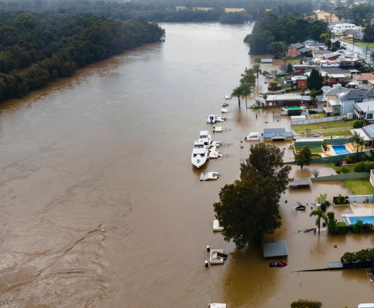
The riskiest locations for insurers in U.S. are Florida, the Gulf Coast, the Eastern Seaboard and wildfire prone areas in the West, according to a recent study by the National Bureau of Economic Research (NBER).

Forecasters generally anticipate an uptick in wildfire-related losses due to climate change along with increased frequency of catastrophic weather events like hurricanes and floods. As a result, insurance carriers are scrambling to secure more accurate risk modeling.

PropertyCasualty360.com recently spoke to Berkley Charlton, chief product officer at Smarty, about technologies and strategies insurers can employ to create a more accurate risk profile for potential customers.

Prior to Smarty, Charlton was the managing director of product management at Pitney Bowes Software, where he led the global data and geocoding businesses to create a suite of location intelligence, geocoding and data products. Charlton also worked as vice president of strategy and business development at the Gadberry Group, where he managed product strategy for geocoding and data products.

PropertyCasualty360: What is “addressing,” and why is it important to risk modeling?

Charlton: Addressing, also known as address verification or validation, involves managing and validating addresses for accuracy and standardization.

Addressing includes three steps. Address autocomplete streamlines entry by suggesting valid addresses as users type. Validation ensures the accuracy and standardized structure of addresses in your database. Geocoding, often a part of address validation, pinpoints the precise location of a building or structure.

Together, these steps enhance data quality, improve user experience, and enable precise location-based services.

PropertyCasualty360: How do you define geocoding, and why is it important to insurers?

Charlton: Geocoding transforms the description of a location, such as an address or place name, into corresponding geographic coordinates that indicate the place’s location on the earth’s surface.

Berkley Charlton

These resulting latitude and longitude coordinates, together referred to as a geocode, are crucial for insurance companies to accurately assess risk, streamline underwriting processes, and ensure precise property coverage.

PropertyCasualty360: How will geocoding help insurance carriers create more accurate risk assessments in disaster-prone areas?

Charlton: Wildfire and natural disaster risk modeling evaluates historical wildfire data, weather patterns, topography, vegetation types, and human infrastructure vulnerability, and uses data to assess the likelihood and impact of such events on specific areas.

For insurers, rooftop-accurate geocoding is crucial. It precisely locates buildings and property assets, allowing insurers to link risks like storms, earthquakes, and crime rates directly to locations. This data helps insurers decide which risks to cover, determine underwriting parameters, and set policy premiums.

PropertyCasualty360: How will geocoding and other address technologies impact insurance policies?

Charlton: Geocoding and property attributes, when paired with a persistent unique identifier (PUID), are crucial for insurance companies to develop an accurate risk profile.

With an accurate risk profile, it’s not only easier to charge an accurate premium for high-risk areas but also to improve loss ratios and obtain reinsurance.

PropertyCasualty360: Will better modeling impact building and development in higher-risk areas?

Charlton: With hurricanes and tropical storms starting earlier and intensifying sooner, coastlines are rising. Insurance companies and government entities need more exact address data about the buildings that may be impacted.

Development impacts may include changes to insurance premiums and coverage areas, placement of emergency resources, and the distance from the coast where new communities are built.

Related: