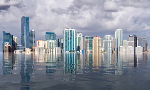
Flood risk drivers: Rising sea levels, extreme weather & the moon
The 2030s are expected to usher in 10 years of increasing flood threats due to the moon’s cycle.
In recent years, cities along the U.S. coastline saw record-breaking high tide flooding, according to the National Oceanic and Atmospheric Administration (NOAA). During 2019, the southeast saw a threefold increase in flooding days. In the western Gulf Coast, the increase was greater than fivefold.
“As a Chesapeake Bay resident, I see the flooding firsthand, and it is getting worse. Records seem to be set every year,” William Sweet, Ph.D., an oceanographer for NOAA’s National Ocean Service, said in a release. “Communities are straddled with this growing problem.”
For states that count their coastal areas among their economic assets, this growing risk becomes even more consequential, points out Kirstin Marr, head of Insurity Analytics. She notes almost a quarter of the businesses generating Florida’s gross domestic product are in 100-year flood zones.
The frequency of flooding in coastal areas has coincided with an onslaught of people moving into high-risk areas. This is particularly true in Florida.
“We are seeing some increased nuisance flood risk from sea-level rise. Florida, and Miami in particular, are seeing increases in the frequency of localized flooding, but this is mainly flooding of streets rather than properties,” says Rob Porter, head of product at Vave.
This past July, Miami was one of the hottest spots for relocations among major U.S. metro areas, according to Redfin. The beaches, beautiful weather and nightlife are a strong enough draw to place flooding concerns on the back-burner for those seeking a new home. However, nearly 60% of properties in Miami face some level of flood risk.
More troubling is the number of locations deemed to be outside of “high risk” zones, which are based on flood maps from the Federal Emergency Management Agency (FEMA), which also administers the National Flood Insurance Program (NFIP).
“For flood risk in the U.S., I think that the nature of the market makes it even harder for homeowners to understand the flood risk of their properties,” Porter notes.
FEMA’s flood maps group risks into V, A and X zone for understanding risk and pricing, but “in reality risk is a continuous spectrum though,” he says. “The NFIP’s approach has the impact of simplifying flood risk to the point where it is very abstracted from reality, driving down take-up rates in the lowest flood risk band (X zone), and pricing policies in a way that often has little bearing on the level of risk.”
He adds that much of the private flood market follows the NFIP pricing approach leading to “herd behavior in pricing and denying policyholders genuine choice.”
While many will note that FEMA’s flood maps might lead some homeowners to underappreciate their true flood risk, Marr explains: “You have to look at FEMA flood maps, but you also have to go beyond that. It’s important to look at building trends too. Construction continues to go up in high-risk areas.”
She notes that strengthening building codes is one area Florida is excelling in, but other states facing growing flood risks, such as Texas and Louisianan, have been less swift to act.
“FEMA has said if we do that (update building codes) in some of these states, we could avoid as much as $30 billion in losses,” Marr tells PropertyCasualty360.com.
As these risks have grown, coverage has been impacted, and the private flood insurance market has shown year-on-year growth, Marr points out.
While the private flood insurance market has been growing, many Floridians are turning to the insurer of last resort, state-run Citizens Property Insurance Corp., as the first option, according to Ken Gregg, founder and CEO of Orion180.
“It (Citizens) is cheaper than everyone, so you are seeing a run to Citizens because of rate increases,” Gregg says. “Because of that, you also have companies that have left the market.”
Premiums have gone up significantly in Florida, and Gregg says Alabama and Mississippi are seeing similar increases.
“A lot of markets have pulled out of there as well,” he adds.
Where the land slides into the sea
While global sea levels show relatively small average increases annually — NOAA reports it is about one-eighth of an inch per year — certain regions do see higher increases of sea level and, in turn, more high tide flooding than others.
“One of the largest drivers in the variability is vertical land motion (i.e., the land sinking), and thus regions where land is sinking faster are seeing a greater increase in both relative sea level and high tide flooding,” says Jennie Lyons, director of public affairs for the (NOAA).
Tides “ride” on top of mean sea level, Lyons explains, so regions that have a greater increase in relative sea-level — primarily due to land sinking — are also seeing the greatest relative increase in high tide and high tide flooding.
“Many locations in the mid-Atlantic, southeast coast and Gulf Coast have high rates of relative sea-level rise and are seeing an acceleration in the number of flood days,” Lyons tells PropertyCasualty360.com. “These areas have also generally seen the largest increase in the number of flood days over the past several decades.”
When the moon hits your tides
By the mid-2030s, every U.S. coastal region will experience rapidly increasing high-tide floods, or so-called sunny day floods, according to the National Aeronautics and Space Administration (NASA), which explains a lunar cycle will exacerbate rising tides and usher in a decade of increasing flood risks in the U.S.
“Low-lying areas near sea level are increasingly at risk and suffering due to the increased flooding, and it will only get worse,” NASA Administrator Bill Nelson said in a release. “The combination of the moon’s gravitational pull, rising sea levels and climate change will continue to exacerbate coastal flooding on our coastlines and across the world.”
The cause of this projected increase in flooding risk is the “regular wobble” in the moon’s orbit, which takes 18.6 years to complete. During half of this cycle, the Earth’s regular tides are suppressed, according to the space agency, causing high tides to be lower than normal and low tides to be higher than normal. In the second half of the cycle, the opposite happens and high tides get higher, low tides get lower. Currently, the moon is in a tide-amplifying phase.
“Along most U.S. coastlines, sea levels have not risen so much that even with this lunar assist, high tides regularly top flooding thresholds. It will be a different story the next time the cycle comes around to amplify tides again, in the mid-2030s. Global sea-level rise will have been at work for another decade,” NASA stated in a release. “The higher seas, amplified by the lunar cycle, will cause a leap in flood numbers on almost all U.S. mainland coastlines, Hawaii and Guam. Only far northern coastlines, including Alaska’s, will be spared for another decade or longer because these land areas are rising due to long-term geological processes.”
Related: