The 2020 hurricane season: Is it really over?
Given the relentlessness of this year’s hurricane season, insurance pros should remain vigilant of possible off-season threats.
On Dec. 1, we usually celebrate the “official” end of hurricane season, but not this year. We should not be surprised that the relentless and record-breaking 2020 North Atlantic hurricane season has continued to produce damaging and costly hurricanes through the end of November. Forecasts as early as September indicated that further landfalls were likely before the conclusion of the hurricane season, which officially ended on Nov. 30. Late-season tropical cyclones tend to develop over the Gulf of Mexico or the Caribbean Sea, where the proximity to land means impacts from these systems are more likely.
October and November generated seven named storms, including four hurricanes. This is well above the climatological average of three named storms, including one or two that become hurricanes. All seven systems formed in the exact areas that climatology have would have us expect: over the warm waters of the Gulf of Mexico and the Caribbean Sea.
Two of these late-season storms, Delta and Zeta, made landfall as Category 2 hurricanes over the northern Gulf Coast just three weeks apart. Delta impacted areas still recovering from Hurricane Laura in southwest Louisiana, while Zeta was the strongest hurricane on record whose center passed directly over the city of New Orleans.
A year of ‘firsts’
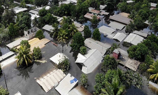
For the first time on record, the North Atlantic basin had two major hurricane formations in November. Eta and Iota intensified over the eastern Caribbean Sea and made successive landfalls as Category 4 major hurricanes in Nicaragua in the space of two weeks in early-to-mid November, bringing catastrophic flash flooding and widespread wind damage to the region.
Impactful events in the hurricane season’s final two months are not unusual. A look back at recent years shows that October and November have produced some notable costly Atlantic hurricanes, including the following:
- Hurricane Opal, which made landfall in the Florida Panhandle in October 1995 as a Category 3 hurricane, causing significant wind and storm surge damage. At the time, it was the third costliest hurricane to hit the U.S.
- Hurricane Sandy, the final hurricane of the 2012 season, transitioned to an extra-tropical cyclone in the hour prior to its landfall along the coast of southern New Jersey on Oct. 29.
- Hurricane Michael, the strongest hurricane of the 2018 season, made landfall near Mexico Beach, Fla., as a Category 5 hurricane on Oct. 10. Michael was the strongest hurricane to make landfall in the U.S. since Andrew (1992) and the strongest October U.S. land-falling hurricane on record.
Although the forecasts indicated that we were likely to see further storms develop during October and November, individual storm tracks are highly sensitive to the location of cyclogenesis and to local atmospheric and oceanic conditions that can’t be forecast reliably more than several days in advance. Forecasters could not say with confidence where they could form or where they would subsequently impact.
Like storm track, the intensity is not well forecast more than a few days in advance, so any sub-seasonal forecasts can’t accurately advise whether the system that develops will intensify into a significant hurricane that could cause considerable damage and loss.
Timely insights
Due to these limitations, RMS predicts the risks posed by individual storms in the short- to medium time scales, consistent with the reliability of global operational weather forecasts. The RMS HWind forecast products, launched in 2019, provide 5-day forecast track scenarios, wind and storm surge footprints, and wind probability analytics multiple times per day once a tropical cyclone is named. Time-sensitive insights allow for a better understanding of the forecast track, timing, intensity, and uncertainty across multiple scenarios to inform proactive preparation strategies, as well as the quantification of potential hazard and loss impacts.
These analytics have been hugely beneficial for clients this season to derive timely insights and support many decisions in advance of a record-breaking 12 tropical cyclone landfalls in the U.S. This includes actions such as internal and external reporting, securing and appropriately positioning claims adjusters and other recovery assets, planning policyholder outreach, and evaluating real-time, or “live” catastrophe coverage, cat bonds, or industry loss warranties.
Of the 12 storms that made landfall in the U.S. this season, five (Hannah, Isaias, Sally, Delta, and Zeta) made landfall at Category 1 or 2 hurricane strength while one (Laura) made landfall at Category 4 major hurricane strength. Six storms made landfall as tropical storms with limited incurred losses.
It’s not over yet
Given the relentlessness of this year’s hurricane season, we should remain vigilant as we enter the season’s closing stages. Impacts into December can’t be ruled out as there are 17 instances of storms developing during the year’s final month. Seven named storms have formed since 1975, equating to an average of one storm every six years. The most notable are the following:
- Tropical Storm Olga, the most recent December tropical cyclone, was a short-lived storm that made landfall in the Dominican Republic in December 2007. The system caused significant damage in the Dominican Republic, Puerto Rico, and Haiti.
- Tropical Storm Odette became the first tropical storm on record to form in the Caribbean Sea in December 2003. The system made landfall in the Dominican Republic, causing widespread damage.
Although a hurricane has never made landfall in the U.S. during the month of December, these other events are a gentle reminder that tropical cyclones can be impactful even in the traditional off-season. However, our industry is well aware that this season has proven to be anything but traditional. As much as we’d like to, we can’t relax yet as you can see by the yellow x in the graphic below.
Based in London, James Cosgrove (James.Cosgrove@rms.com) works within Model Development as a member of the RMS Event Response team, supporting real-time Event Response operations and assisting on various Event Response projects.
Related: