Traveling over the hill

When determining who is at fault for accidents on blind hills, speed and location are just two factors to consider.

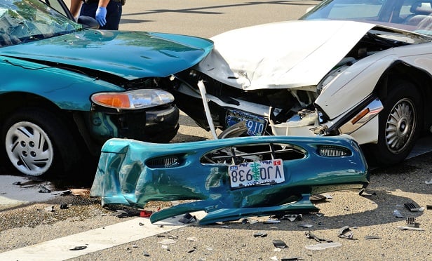
When a collision occurs just over a hillcrest, the turning driver is often charged with failure to yield the right of way, but other factors may come into play when determining fault. (Photo: Shutterstock)

When traveling on the road, many risks must be considered. While there are some obvious concerns, those that are unseen also pose a threat. Blind hillcrests leave drivers guessing “what’s on the other side.” Regardless of their intentions, before drivers make a maneuver, they should pay extra attention to blind hillcrests.

In a collision that occurs just over a hillcrest, where one driver is attempting to continue straight as the other is attempting to make a left-hand turn, many times the investigating officer arrives at a common conclusion. Failure to yield the right of way charges are often applied to the driver making the turn; however, are these charges applicable?

In this scenario, the speeds of the vehicles involved need to be determined. This can be done by completing speed calculations, which require crash scene documentation of the collision. Hopefully, evidence such as skid marks, yaw marks and other physical evidence are still visible. Speed can also be found by imaging the event data recorder (EDR) information frequently available in modern vehicles. An analysis of this data gives the most accurate speeds if the system functioned properly and the vehicles’ safety system was engaged. An investigation is more involved than determining if anyone was speeding.

Accident reconstruction

To understand the sequence of events involved in this type of collision, a reconstructionist must complete a time-distance study of the crash. Much like the speed calculations, they will need documentation of the collision scene. In speed calculations, they are looking for the positions of the vehicles at the beginning of skids, the point of impact and final rest so they can determine how fast the vehicles were traveling. However, in a time-distance study, they are looking for how much distance the vehicles covered at the determined speeds and where the vehicles were in relation to each other when things began to transpire.

In the example of a blind hillcrest, was the vehicle attempting to continue straight visible to the driver on the other side of the hillcrest that was attempting to make a left turn? Using the speed that the vehicle was traveling as it attempted to travel straight through in conjunction with any speed that vehicle lost from skidding, that vehicle must be backed up from the impact with the turning vehicle. Likewise, using the determined speed of the turning vehicle, that vehicle must be backed up from the impact. Using mapped data from the collision area, a scaled diagram can be created from the collected data.

Mapped data will give lateral and longitudinal locations and the elevation of mapped points. A scaled diagram using this data will capture the slope and superelevation of the roadway for a 3-D depiction of the crash scene. With vehicles in the diagram scaled to match the width, length and height of the vehicles involved in the crash, perspectives set at the measured heights of the drivers of the vehicles will show what they were able to see or not see as they maneuvered on the highway in the proximity of the hillcrest.

From the view of the vehicle turning left, can they see the vehicle that is approaching them? Which leads to the question, how can they yield to something they cannot perceive? If the vehicle continuing straight was found to be above the posted speed limit (it is always good to know where and when the speed limit sign was erected), does that influence the collision? This is also a good place to point out that mapping the damage profiles of the vehicles helps to show how much of the vehicle was able to clear the area of impact, and how much had not cleared at the time of the collision. If the impact on the turning vehicle is at the front-most portion of the vehicle, then it is obvious that it still needed a lot more time to clear the crash area than if the impact was to the rearmost portion of the vehicle.

Once the location of the vehicles as they approached the collision is determined, the investigator can now examine the factors that could have been changed to prevent the collision. Did the driver of the turning vehicle turn too slowly and hesitate to cause the crash? Was the driver of the oncoming vehicle traveling above the posted speed limit? If the driver had been traveling at the speed limit, would the collision still have happened? Does the State Department of Transportation have a contributing factor in the collision because of their roadway design in relation to the posted speed limit? These answers require time, distance and a thorough reconstruction.

Aaron (Al) Duncan II, ACTAR, is a vehicle collision reconstructionist with Warren, a consulting and forensic engineering firm. Prior to joining Warren, he worked for 23 years as a South Carolina Highway Patrol Trooper, including 10 years as a Multi-Disciplinary Accident Investigation Team (M.A.I.T.) member. 

Related: