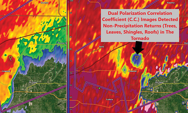
 Figure 1. Rain, hail and debris can be detected by Doppler radar, providing forecasters and insurers with valuable weather insights. (Photo: Forensic Weather Consultants)
Most people are familiar with Doppler radar from television newscasts because it shows where it is raining. However, Doppler radar, also known as Weather Surveillance Radar — 1988 (WSR-88D), is much more valuable to experienced meteorologists because it can confirm whether a tornado is on the ground, whether hail is present in a thunderstorm, where smoke and chemical plumes from large fires are spreading, and other potentially dangerous weather events.
Recommended For You
Want to continue reading?
Become a Free PropertyCasualty360 Digital Reader
Your access to unlimited PropertyCasualty360 content isn’t changing.
Once you are an ALM digital member, you’ll receive:
- Breaking insurance news and analysis, on-site and via our newsletters and custom alerts
- Weekly Insurance Speak podcast featuring exclusive interviews with industry leaders
- Educational webcasts, white papers, and ebooks from industry thought leaders
- Critical converage of the employee benefits and financial advisory markets on our other ALM sites, BenefitsPRO and ThinkAdvisor
Already have an account? Sign In Now
© 2025 ALM Global, LLC, All Rights Reserved. Request academic re-use from www.copyright.com. All other uses, submit a request to [email protected]. For more information visit Asset & Logo Licensing.


