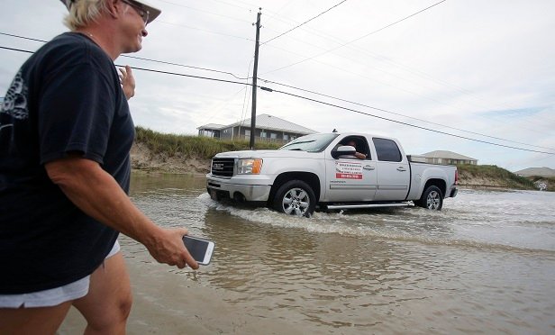
 Susan Jones waves to a truck driving through a flooded road from Tropical Storm Gordon on Wednesday, Sept. 5, 2018 in Dauphin Island, Ala. (Photo: AP Photo/Dan Anderson)
Gordon, which has been downgraded from a tropical storm to a depression, made landfall along the Gulf Coast late Tuesday evening, hitting Mississippi and Alabama with torrential rains and near-hurricane force winds of up to 70 mph.
Recommended For You
Want to continue reading?
Become a Free PropertyCasualty360 Digital Reader
Your access to unlimited PropertyCasualty360 content isn’t changing.
Once you are an ALM digital member, you’ll receive:
- Breaking insurance news and analysis, on-site and via our newsletters and custom alerts
- Weekly Insurance Speak podcast featuring exclusive interviews with industry leaders
- Educational webcasts, white papers, and ebooks from industry thought leaders
- Critical converage of the employee benefits and financial advisory markets on our other ALM sites, BenefitsPRO and ThinkAdvisor
Already have an account? Sign In Now
© Touchpoint Markets, All Rights Reserved. Request academic re-use from www.copyright.com. All other uses, submit a request to [email protected]. For more inforrmation visit Asset & Logo Licensing.


