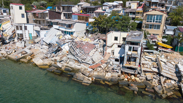
Recent catastrophes have highlighted lingering problems for property & casualty insurers: Do carriers understand what their risks are and can they locate their policies and assets. In other words: location intelligence.
Pitney Bowes Software has rolled out Spectrum Spatial, which is part of the Spectrum SOA platform, according to Lamont Norman, global geocoding and risk data product manager for Pitney Bowes Software.
“This allows customers to geocode and perform at-risk quality and location-quality operations in the back office quickly without a software engineer and then be able to pass that information and quickly analyze and understand what the risk is,” says Norman. “We tie that to static risks or what we call slower-developing risks, such as earthquake or hurricane risks.”
Norman explains the system uses weather feed information about severe storms coming through an area to determine the insurer's exposures and how many policies can be affected by such a storm.
“We can interface with the customer's existing systems through web services and pull that information together to give insurers a timely understanding of what is happening when there is a catastrophic event,” he says. “You can operationally explain these are the policies you are interested in and of a certain value, and are part of a particular book of business in the region.”
Companies are working with Pitney Bowes Software on the operational side and as they become more aware of what the software can do—such as support insurers on the analytical side as well—insurers are seeing that the system can help them with these problems, according to Norman.
Processing a claim is one of the most important transactional events between the insurer and the customer, points out Norman, and how well the insurer settles the claim is important.
“We've begun to have conversations with the claims folks as well as the catastrophe management folks to understand if there is a fraud issue or if you are sending adjusters in a timely manner,” he says. “If you don't get your people out there quickly enough, customers tend to get more litigious and that ends up costing the insurer more money.”
A lot of insurers have mapping capabilities, but not the ability to combine maps with intelligence, points out Norman. He adds that some insurers have the intelligence and need the maps to see what's going on.
“Being able to distribute that so companies can make decisions is drawing a lot of interest in the industry,” says Norman.
Global warming and climate change are subjects that insurers don't like to talk about, adds Norman. He explains Pitney Bowes Software is not in the business of predicting climate change.
“That's not what we do,” he says. “We enable insurance companies to better understand weather information that is available to them. There are a number of companies that provide accurate weather information and the insurer has to relate that to their policies and their exposures. That's what we do. We are not in the climate business.”
Want to continue reading?
Become a Free PropertyCasualty360 Digital Reader
Your access to unlimited PropertyCasualty360 content isn’t changing.
Once you are an ALM digital member, you’ll receive:
- Breaking insurance news and analysis, on-site and via our newsletters and custom alerts
- Weekly Insurance Speak podcast featuring exclusive interviews with industry leaders
- Educational webcasts, white papers, and ebooks from industry thought leaders
- Critical converage of the employee benefits and financial advisory markets on our other ALM sites, BenefitsPRO and ThinkAdvisor
Already have an account? Sign In Now
© 2024 ALM Global, LLC, All Rights Reserved. Request academic re-use from www.copyright.com. All other uses, submit a request to [email protected]. For more information visit Asset & Logo Licensing.


